


Top minds want closer eyes on coast
 Print
Print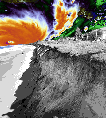 Experts say they are ‘working blind’ when it comes to predicting erosion along most of Australia’s coast.
One of the world’s longest-running beach erosion research programs, at Narrabeen in Sydney, has become a high-tech scramble to predict what climate change will do to Australia’s coastlines, but it is far from the standard.
Using drones, real-time satellite positioning, cameras, airborne LiDAR and quadbikes, researchers have been tracking the variability, changes and trends in coastal erosion at Narrabeen-Collaroy, first begun in April 1976.
The long-term data has been crucial in understanding how climate change is changing Australia’s coasts, recently showing that El Niño and La Niña cycles will increasingly intensify coastal hazards, leading to a rise in storm events, extreme coastal flooding and erosion in populated regions across the Pacific.
As a result, estimates of coastal vulnerability – which once focussed on sea level rise – now have to factor in changing patterns of storm erosion and other coastal effects.
But the data collected by the UNSW team is only reliable for computer modelling when it comes to predicting effects in south-eastern Australia.
When it comes to the vast bulk of Australia’s 25,760 km long coastline, researchers – and the governments and coastal communities they advise – are making guesses based on largely non-existent data, say researchers.
“The wealth of data we’ve collected consistently over decades makes our models of coastal variability increasingly more reliable – but only for a 500 km stretch of south-eastern Australia,” said Professor Ian Turner, Director of UNSW’s Water Research Lab.
“But when it comes to modelling other parts of Australia, we are basically working blind. There are very different coasts exposed to very different conditions, and we just don’t have the observational data we need to make predictions with any great confidence,” he added.
“For that, we need a National Coastline Observatory.”
Researcher Dr Mitchell Harley says that beach erosion and coastal variability is a lot more complex than had originally been thought.
“It’s now clear that sea level rise is not the only player in climate change: shifts in storm patterns and wave direction also have consequences, and distort or amplify the natural variability of coastal patterns,” Harley said.
“Our data has been pivotal in understanding this. But it’s also made it clear that, to predict the future changes with any degree of reliability around Australia, we need data from other parts of the country. And currently, this is lacking”.
The experts say that a National Coastline Observatory is needed, with basic data – such as sub-aerial profiles, bathymetry and inshore wave forcing measurements – collected monthly from a network of around 15 – 20 ‘representative’ beaches around Australia.
This would provide valuable data that could be used to much more accurately model how Australia’s more than 11,000 beaches are changing, and predict how they will respond as climate change sets in.
“For the great majority of Australia’s coastlines, we don’t have observations for how they are behaving now – let alone any idea how they might respond to increasing variability in the future,” Dr Harley said.
“We see it happening at Narrabeen-Collaroy, and can therefore predict it for this part of Australia. But elsewhere, it’s really anybody’s guess.”